 Slovenski INSPIRE metapodatkovni sistem
Keyword
temperature v globini 1000 m
1 record(s)
Type of resources
Categories
INSPIRE themes
Keywords
Formats
Representation types
Resolution
-
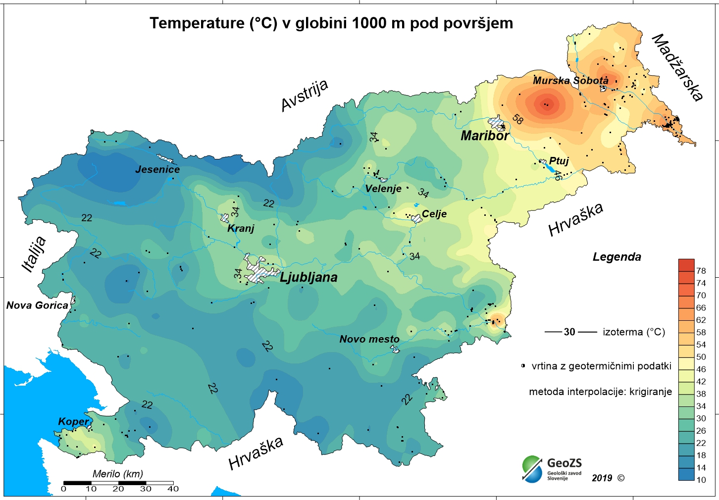
The underground geothermal conditions can be presented, irrespective of the aquifers' position, with the appropriate geothermal maps. This map represents the expected temperatures at a depth of 1000 m and is made with data from 302 boreholes. It is made on the basis of measured temperatures in accessible boreholes throughout the country. However, since the temperature field depends on the geological structure in the depths and tectonic characteristics, the course of the isotherms is a result of many influences, such as thermal conductivity of rocks, permeability and fracturing of rocks, all of which are reflected in the measured temperatures in boreholes. The distribution of boreholes, which were useful for the measurement of temperature, is very uneven and different as regard the depths. Following the expected temperatures at a depth of 1000 m a stronger positive anomaly is in the northeastern part of Slovenia, especially between Maribor and Murska Sobota and further to the Hungarian border and at Lendava, as well as in a smaller eastern part of the Krka basin. In the northeastern part of the country the anomaly is the result of the thinning of the Earth's crust and greater conductive heat flow from the Earth's mantle.